
Susanne Paulus is an associate professor of Assyriology in Near Eastern Languages and Civilizations and the tablet collection curator at the Oriental Institute. Interested in ancient writing since she was a schoolgirl in Germany, Paulus now examines real estate documents—in the form of cuneiform tablets—from Babylon’s Middle Babylonian Period (1500–1000 BCE).
There are two ways to approach ancient cultures. One is through the material cultures—through archaeology—and the other is through the textual culture. I think we get the most out of it if we combine those perspectives.
Real estate documents tell us that in terms of ancient cities, location does matter. If you’re close to a really important temple in Babylon, or close to the king, that’s where you want to be. If you’re an adviser to the king, you have to see the king regularly. There is no subway system; you don’t have a car. A lot of things happen just by being close to power.
As in a lot of modern cities, including Chicago, the river is a focal point. And not all the land is built. We see that people had gardens for fruits and vegetables. The city center in Babylon is pretty densely occupied—houses, streets. But the further we move out of the center, the more gardens and green space we see. Even most of the smaller houses have courtyards, where there is a lot of daily activity.
There is also a surprising amount of activity on the rooftops. For example, when I visited traditionally built cities in Iran, you could walk from one rooftop to the next rooftop. Archaeological sources usually take the ground level of things, but my texts sometimes mention roofs, so I started paying a lot more attention to what’s happening on those upper levels. We know, for example, that they store grain on the roofs, or they go up on the roof to observe the stars.
There is definitely income inequality—it’s a typical triangle society, with the king on top and a small elite. There is also definitely diversity. The texts speak of different ethnicities. There has been a lot of ink spilled on the topic, but it’s really hard to tell if a person’s ethnic designation influences their status in society. We know the Babylonians perceive some people as foreigners. They fight wars constantly, so they have prisoners of war, and elite households had slaves.
But there is not any official segregation or redlining that I’m aware of. The way they kept housing markets socially stratified, then as now, was price. If you ask a certain price for a house, only a certain social stratum can afford it. The few examples that come to my mind speak to the fact that ethnicity doesn’t play a role.
What we do know is that usually extended families want to live close together, and they do everything to buy houses next to each other. Building walls made of clay allows them to be very flexible. So if you’re sharing a wall with your neighbor and the neighbors are your cousins, you could open a wall just to connect houses.
In private houses, you also find a lot of school texts. I recently taught two classes on schooling in Nippur, a Mespotamian city excavated by the OI. My graduate students enjoyed discovering the work (and struggles) of students who lived more than 3,700 years ago.
Jason Salavon is an associate professor and chair in Visual Arts. His studio uses custom computer software processes of his own design to manipulate and reconfigure preexisting media and data to create new works of visual art.
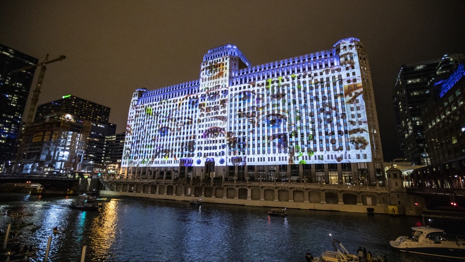
One of the issues my work has attempted to tackle for a long time is a kind of simultaneity of the microscale, or scale of individual entities, and the macroscale, or scale of groupings. Cities are a really interesting site for that investigation. If you look at the contents of a large building during the workweek you have this macrostructure of swarming activity. And then, with difficulty, you might try to imagine all of the small local—even subjective—narratives in each of the building’s offices, cubicles, and workspaces.
Something that contemporary computer technology allows us to see is that those distinct points of view can be held at the same time. You can hold the representation of a kind of macroperspective and a zoomed-in microperspective in the same artistic representation or, more frequently, database entity.
For example, I had a project where I was interested in this question: is it possible to simulate every building in the Loop—including buildings that no longer exist and buildings that were going to be built—and render them such that you might get a sense of some simultaneous full expanse of the cityscape from a single camera perspective? That led to my pieces City (westward) [featured on Tableau’s Spring 2014 cover] and City (southbound).
Most popular narratives focus on an individual story. I understand why, and I agree that the personal, local-scale story, and the feeling that the telling of stories engenders in others, is important. At the same time, I really am interested in how multitudes of stories quilt into a dense and complex entity that has its own life: the life of the entire city, not the life of the individual.
Those are definitely harder stories to tell, and they’re harder stories to get people to attach to emotionally. But perhaps with computational image-making and other fine art forms, one can get to those things in a way that audiences might have some strong feeling for.
The way we tell macrostories tends to be dry and analytical. It is the narrative of the economist and the cosmologist. I’m not sure that detachment is a requirement, though. And I think contemporary art is a place where one can explore those large-scale phenomena in simultaneity with the smaller scale. That city piece is trying to address the fact that the literal scope of one’s own field of view—what one can see—is necessarily limited. There might be ways to have that kind of personal, local scope live in concert with different kinds of scopes that are only available to technology processes that combine many fields of view.
Another example is American Varietal, a 2009–13 project I did for the US Census Bureau. This project is essentially a rendering of US County data from 1790 to the present. All the humans that were counted in all these different places represent points in a complex visual architecture. In that case, it’s more about the humans and where they reside than the architecture they reside in.